Home / Real estate / Land / Land surveying
Back
Published: 03/09/2017
Reading time: 10 min
0
1241
Many residents of our country own their own land. However, not everyone knows about its borders and area.
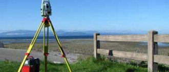
To make this known down to the smallest detail, special services carry out land surveying.
Carrying out this operation is necessary to avoid disputes with neighbors and successfully conduct transactions with land plots.
- What is land surveying
- Documents required for land surveying
- Land surveying with and without a cadastral number
- How long will it take to prepare documents?
- General conclusions
What is land surveying
First, I would like to briefly tell you what it is. Land surveying is a geodetic operation associated with measuring the boundaries of a plot exclusively in the horizontal plane.
This is necessary to create a new land plot, or in cases where it is necessary to accurately determine the boundaries of the plot itself, or for the purpose of registering it as property.
For this, citizens turn to geodetic services, strictly guided by the legislation of the Russian Federation.
Documents required for land surveying
Before hiring land surveyors from the geodetic service, a citizen must be sure to familiarize himself with the list of all documents that are needed to carry out the land surveying procedure so that the law is not violated and the neighbors living around the site are not outraged.
The list of required documentation may vary depending on whether an individual or legal entity requests a procedure for geodetic measurement of a site.
For individuals, this list is as follows.
Basic documents for conducting land surveying:

- First of all, here you need a document confirming the identity of the person requesting this procedure, preferably a passport;
- legal documents, including:
- purchase and sale agreement (if the plot was previously purchased by this citizen from another person)
- gift agreement (if the plot was donated by another person)
- certificate of inheritance (if the plot was inherited)
- resolution of the administration of a constituent entity of the Russian Federation on the issuance of a plot to a citizen in cases where the plot was transferred to the owner by the authorities
- certificate of state registration of rights (if the owner submits an application for inclusion of the site in Rosreestr)
- boundary plan;
- cadastral passport;
- application for carrying out surveying work on the site;
- extract from the land registry.
So, here is an approximate list of the main documents required for carrying out site measurement work, if they are collected by an individual. But something else needs to be said about additional documents.

If a citizen makes a request for land surveying not on his own behalf, but through a representative, then he will definitely need to issue a power of attorney, as well as a package of copies of documents certified by a notary, otherwise land surveying in a representative way will not take place.
It may also be necessary to provide an act of approval of the boundaries of the land plot, as well as a notification that there are no communication wires nearby if the plot is located within the boundaries of a city, village, village, gardening association, cottage community, etc.
The final list of documents will depend on each precedent for filing a request for land surveying.
Owners who own a plot of land next door to someone else need to remember that they will need the consent of their neighbors to survey the land plot.
If this consent is not given, then the neighbors can act as plaintiffs at a court hearing if they have claims to the land and the entire package of official documents justifying these claims.
For legal entities, the following documents are also provided:

- power of attorney confirming all powers;
- TIN certificate;
- certificate of state registration of a legal entity;
- documents from government services confirming the presence of these legal entities in databases (individual entrepreneurs or organizations) in order to avoid fraud and fraud.
power of attorney for land surveying can be found here.
Is it possible to do land surveying without land documents?
There are frequent situations in which some documents are lost, some papers are damaged or are not in full possession of the owner. Please be aware that without a Russian citizen’s passport and without documents confirming the owner’s rights to the plot, the application will not be accepted for consideration.
However, it is possible to restore all the documents necessary for land surveying and subsequent registration of the site in Rosreestr by creating duplicate documents. Know that cadastral engineers themselves can help restore or re-obtain some of the documents, but it will cost a certain amount.
Information from cadastral services, from the BTI, from urban planning organizations involved in land management issues can be obtained by the specialists themselves who carry out boundary work.
Was the Recording helpful? No 2 out of 5 readers found this post helpful.
Land surveying with and without a cadastral number
The procedure for preparing documents for land surveying will differ depending on the presence or absence of a cadastral number for the site that is supposed to be demarcated.

This number is usually displayed in the cadastral passport. In addition to the number, this document also contains other information about the owner. But what if this number and all the necessary accompanying data on your site that is planned to be surveyed are missing?
In this case, the preparation of documents for further land surveying procedures will be preceded by the process of assigning a cadastral number to your site.
If your plot does not have such a number, it means it is not registered with the cadastral chamber and is not registered in state registers.
Accordingly, there is no cadastral passport, which the owner must present along with other documents allowing for land surveying.
To obtain a cadastral number, you must contact the cadastral chamber with the originals of all documents on the site.
Based on these documents, the cadastral specialist will register the plot, and it will be assigned a number, and the owner will receive a cadastral passport within 20 working days. Thus, we see that preparing documents for a land plot without a cadastral number will take more time and, accordingly, the land surveying procedure may be somewhat delayed.
What documents are needed to clarify boundaries?
To clarify the boundaries, the owner of the site will have to first prepare all the necessary documents. Here is a sample list of them.
Passport
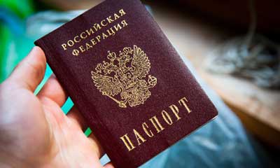
It is necessary so that the identity of the owner of the land can be confirmed .
If his authorized representative acts on behalf of the landowner, representing the interests of the owner, then a representative passport will be needed.
In such a situation, you also need a document confirming his authority.
It is a power of attorney signed by the owner of the property and certified by a notary.
In addition to the originals, copies of passports and powers of attorney may also be required .
Proof of ownership
Title documents make it possible to verify that the citizen ordering the land survey is actually the owner of the site .
In accordance with the norms of Russian legislation, these include :
- land purchase and sale agreement (PLA). It will be needed if the land was purchased from another person;
- land donation agreement (if the owner of the land received it as a gift from a relative or any other person);
- a certificate confirming the fact of acceptance of the inheritance (in the case where a citizen became the owner of land ownership as a result of receiving an inheritance);
- if the plot was received for use from local authorities, it is necessary to present a resolution from the administration granting the applicant a land plot;
- certificate of registration of rights to a property (it is issued by Rosreestr when registering ownership of a plot).
What kind of document of ownership will be needed depends on the method of acquiring the land plot (with the exception of the certificate of state registration of land rights, it is needed in all cases).
Copying to the ground
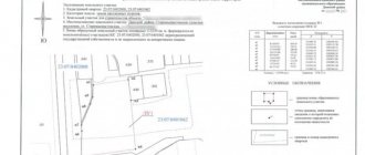
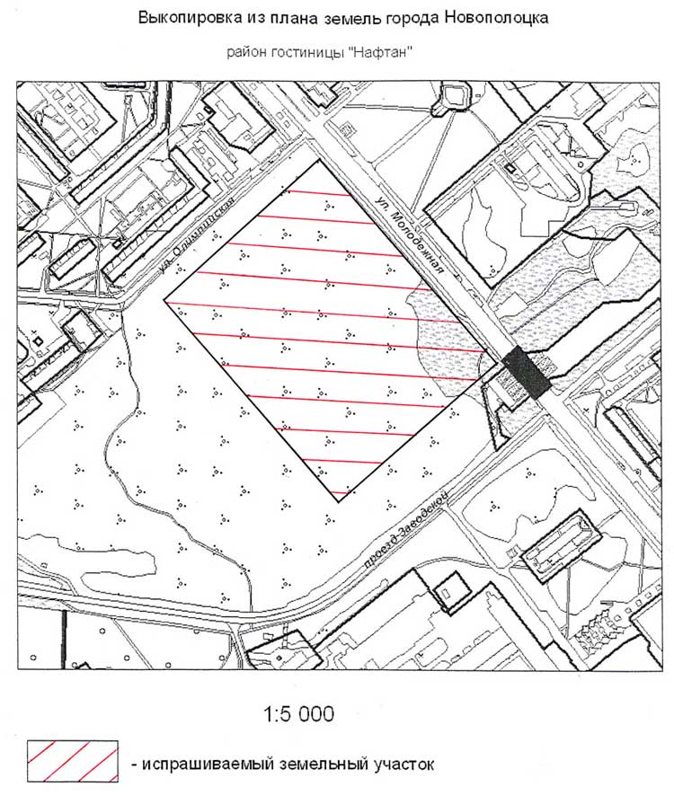
A copy is a copy of part of the general plan of the settlement, which depicts the territory of the site to be surveyed and the neighboring lands immediately adjacent to it. In essence, this is a detailed plan of the land.
The copy can be made in color or be a black and white image.
Must be present:
- symbols;
- the scale to which the plan was implemented;
- surname and initials of the compiler, his signature;
- date of document production.
To obtain this document, you should contact the architectural department of the municipality on whose territory the land plot is located. It can also be certified by the local administration.
Currently, it can be ordered at the MFC at your place of residence. The finished document will be received within 3 days from the date of application . A photo sample of it is shown in the figure below.
Cadastral passport
It contains all the information about the site included in the State Real Estate Cadastre . Previously, a cadastral passport could be obtained at the Rosreestr branch at the place of residence or at the MFC. Now such a document is no longer issued, since it was abolished as of January 1, 2021 .
Now, instead of it, an extract from the Unified State Register is issued.
An application for its production should be submitted to the same institutions where it was previously possible to obtain a cadastral passport.
The extract from the USRN consists of several pages.
It includes the following information:
- data on the physical characteristics of the land plot: its area, land category, coordinates;
- graphic plan of the site;
- cadastral number of the object and the date of its assignment;
- cadastral value of the site;
- Full name of the owners or other persons who have the rights to use the property;
- information about the documents on the basis of which the land was acquired;
- date of registration of land ownership rights;
- restrictions or encumbrances under this lease (for example, mortgage or lease).
A sample statement can be found by going to
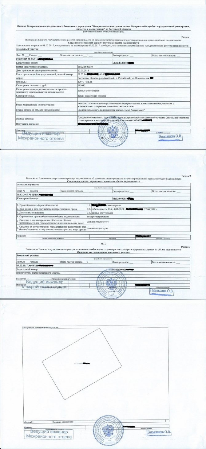
.
Owners of land plots who have issued cadastral passports for them before 2021 can still use these documents if necessary. Their effect remains in force if no legally significant changes have occurred to the real estate objects or documents on them.
Cadastral plan of the territory
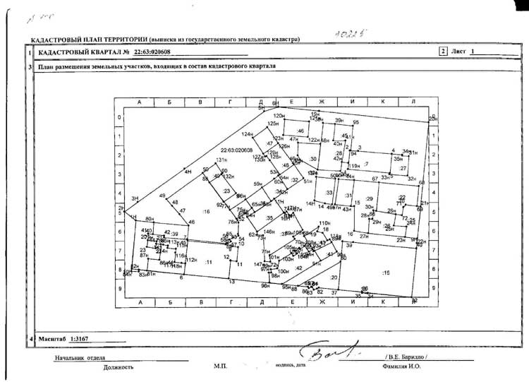
A cadastral plan is a drawing of the entire territory of the cadastral quarter in which the land is located. You can also get it from Rosreestr .
Now it can be ordered not only as a separate document. It is also possible to request an extended extract from the Unified State Register. It will include, among other things, this plan. A sample of it is shown below.
How long will it take to prepare documents?
Citizens who intend to demarcate a plot of land will ask themselves: how long will it take to prepare documents and what financial expenses are expected in connection with this? It should be remembered that the site surveying procedure itself will take no more than 10-14 working days.
However, it is recommended to notify your neighbors about the upcoming land survey a month before the start of work.
If everything turns out to be in order and Rosreestr does not require you to correct the documents, then

the boundary plan will be ready one and a half months after all documents are in good condition and submitted on time.
Also, do not forget that if you do not have a cadastral passport, it will take about 20 working days for the cadastral specialist to register the land plot, and for the owner to receive the cadastral passport necessary for preparing the collection of documents.
If we talk about the cost of preparing documents, then the expenses will go to a notary who certifies the documents (if the registration is carried out through a representative). As for the cost of surveying work, it will depend on the labor intensity and the price per standard hour. The price per standard hour is determined depending on the salary of the cadastral engineer.
Labor intensity is calculated from a combination of factors that contribute to the complexity of a job.
Therefore, the final cost of surveying a specific plot will consist of the number of standard hours of the engineer plus various features of the given land plot.
You will read in our article how to draw up a purchase and sale agreement for a land plot with installment payment! Do you need to temporarily register in Krasnodar? Then it will be useful for you to read our article.
Have you already remodeled your apartment? Now it definitely needs to be legalized! How to do it correctly, read here.