Home / Real estate / Land
Back
Published: 11/16/2017
Reading time: 6 min
0
564
When choosing a territory for purchase, in addition to its visual appeal and reasonable price, you should find out the status of the site, since it is this that determines the nature of the legal use of the land.
Knowing the status will allow you to comply with legal norms when operating the site and not become the owner of an area that is not suitable for its intended purpose.
- What is the site status?
- Types of statuses Temporary
- Canceled
- Accounted and previously accounted
- Archival
What statuses of land plots exist?
There are several categories of land ownership, assigned upon registration and changed only under certain conditions. Speaking about land territories, it is meant that they may have the following statuses:
- taken into account;
- previously taken into account;
- temporary;
- canceled;
- archival.
It is worth understanding what the status of a land plot means. From the moment of registration of property rights and cadastral registration, the plot belongs to the registered category. As for “previously registered” plots, these include land territories, the right to which was registered before March 2008.
Most often, these are objects with undemarcated boundaries and in the register they are listed as areas that do not have precise boundaries. Land classified in this category may be used only to a limited extent. The land user acquires the opportunity to fully dispose of the allotment only after land surveying .
The recorded areas are distinguished from previously recorded ones by the fact that for the former there is complete information about their boundaries and other characteristics. Records of this are included in the state real estate cadastre. In addition, a certificate confirming the owner’s ownership is issued for registered objects.
Temporary cadastral status of a land plot is assigned to plots with undefined boundaries and non-privatized plots leased for a certain period. Also, a property acquires temporary status for the period while the full registration procedure lasts.
If the registration procedure is not completed properly within the established time frame, then after 5 years the plot will be automatically removed from the cadastral register. In this case, it will receive the “cancelled” status, and all actions will have to be repeated from the very beginning.
The status “archive” is assigned to territories under the circumstances established by law and after a certain time. The procedure is carried out without a request from the land user.
What does temporary status mean and why is it dangerous?
First you need to understand what the status of a land plot is.
The fact is that each piece of land is endowed with certain characteristics. The status is assigned when the land is registered for cadastral registration and is considered current until it is recorded in Rosreestr. What information does each status carry?
Canceled
If, within the allotted period from the moment of registration of the land, registration of rights does not occur, then the plot is deregistered and receives the status “cancelled”.
A land plot with this status will have to be registered again or this issue will have to be resolved in court. In this case, no extenuating circumstances are taken into account - the status must change.
Accounted
After registration of lease or ownership rights to a plot, the status of cadastral information changes to “registered”. Only this status allows the copyright holder to completely dispose of the site.
Previously taken into account

If the land surveying procedure has been carried out, then the status of the record “previously recorded” gives the copyright holder the opportunity to fully dispose of the site.
Archival
Sometimes land plots with the status “registered” or “previously registered” are divided by the owners into several new ones. New areas are being formed, separated from one territory.
After the allocated shares are registered by the owner (one or more) and receive the “registered” status, the original land plot is given the “archive” status.
Temporary
Each of the above statuses carries certain information about the object.
When a land plot is registered in the cadastral register, information about it is entered as “temporary” and remains in this status until the ownership of the plot is registered.
Thus, land plots with the “temporary” status are territories for which ownership or lease rights are not registered.
The concept of temporary status of a land plot first appeared in Federal Law No. 221 of July 24, 2007 “On the State Real Estate Cadastre”. The introduction of temporary cadastral registration made it possible to separate land plots, the right to ownership of which passes from one owner to another.
This status is assigned at an intermediate stage, when the rights to own a land plot have already been transferred, but the plot itself has not yet been fully privatized.
Previously, when there was no such thing as temporary registration, citizens had to wait several years for the completion of full registration, which made it impossible to use the land for its intended purpose. The introduction of temporary cadastral registration corrected this disadvantage.
The expiration date of the temporary nature of the land plot indicates that from that moment the plot will be removed from the cadastral register and will acquire the status of “cancelled”.
From January 1, 2021, cadastral registration and registration of rights to real estate (including land) is carried out according to new rules. In accordance with the new edition of Federal Law No. 2021, the temporary status of the land plot will remain until March 1, 2022.
This means that land plots placed on temporary registration before January 1, 2021 retain this status until the registration of the right or lease, but no later than March 1, 2022.
Thus, the temporary status of a land plot will be automatically removed from cadastral registration if rights to it are not registered in the Unified State Register of Real Estate. After cancellation of rights, the land plot becomes the property of the state without the right of return.
In Art. 72 Federal Law No. 218 indicates the following features of areas with temporary status:
- new plots cannot be formed from such land area of the plot;
- it can be removed from the register during the period of validity of the temporary status at the request of the owner or local government body.
Certified status for a site registered on a temporary cadastral register means that this land belongs to the state. Temporary lease of property does not give full rights to the user of the land.
The following categories of land are relatively freely available for use:
- Part of the territories classified as settlements.
- Agricultural areas.
- Areas related to forestry and water management.
It is also worth additionally noting some features that are directly related to the use of plots:
- For example, areas that were originally intended for agricultural activities do not allow permanent residence on them. It is allowed to build a country house, but you cannot register. There are no restrictions on buildings for commercial purposes.
- If the house was built on plots intended for individual housing construction, then registration in such housing is allowed.
- According to the law, lands located in the coastal zone of water bodies are subject to special protection. During construction, the minimum distance to the shore should be twenty meters. It is also not allowed to fence this area.
- The smallest size of the plot on which it is planned to build a house is four acres. You should also not forget that in any case it will be necessary to obtain the appropriate permits and approvals from the authorized bodies.
- If you plan to build a house in areas that initially have an agricultural purpose, you will need to change the purpose of the land plot in accordance with the law.
The concept of temporary status was discussed above, but it is worth considering it in more detail and noting some nuances that make it worthwhile to think twice about purchasing such a plot.
For example, it will be possible to change the status of a temporary site only in the following cases:
- Register ownership of this land area.
- When registering the right to lease a given area. This option will be relevant if the owner of the land is any municipal company or the state itself.
We suggest you familiarize yourself with: Calculation of interest for the court.
Also, do not forget the following:
- In fact, areas with the status of “temporary” are completely state property.
- In theory, such lands can easily be transferred for the construction of any communications or transport networks.

The full volume of data regarding all land use criteria is entered into the Unified State Register.
It is important to find out the features and differences between the temporary and permanent status of the areas, namely:
- The entire volume of initial data is a preliminary basis for registration, that is, it is temporary.
- Based on primary information, it is legally prohibited to formalize and approve any scope of legal procedures.
- Lease agreements, sales and purchases, inheritance and donations are not possible in the legal field.
- Replacing temporary data with permanent ones. After state registration of the relevant ownership rights to a certain plot.
Failure to continuously register land for 24 months leads to serious legal consequences. They are automatically completely removed from state registration. Subsequently, the owner who missed it no longer has the opportunity to register these territories as real estate.
To obtain a particular plot of land, it is necessary to determine the legal position - whether the selected plot is free from encumbrances or not. The legislation provides for the use of relatively vacant lands as real estate for civil use, transferred to individuals and legal entities.
The legal category of temporary status of land in the modern legal field of the Russian Federation implies certain difficulties for their owner. General issues were discussed earlier; then the range of problems and ways out of them should be defined in detail. The need for a detailed study of the special nuances of temporary site design is extremely important.

By paying attention to several nuances, a citizen will be deprived of many problems regarding changing status from temporary to permanent:
- when registering the owner's rights to a land plot;
- the lease agreement for the specified plot has been issued or cancelled;
- the owner of the territory is a state company, a municipal enterprise;
- the recorded area is under state management.
The last category of land is transferred for construction work on the construction of transport communications and networks of any other nature.
Why do you need information about the status of a site?
Today, most of the previously recorded land areas are not demarcated. According to the current legislation in the field of land use, the owner is obliged not only to have documents confirming that the land is owned, but to register the exact boundaries of his plot.
The absence of boundaries established by the cadastre engineer as a result of boundary work prevents transactions with these land areas.
Therefore, owners have to find out the current status of the land plot in order to know about the existing rights.
The fact is that inaccurate boundaries of land objects one way or another lead to the intentional or unintentional seizure of land from neighboring territories. The difference between the actual dimensions and those registered in the title documents can sometimes be quite significant.
In addition, in this case, the calculation of the fee for operating the facility also becomes erroneous.
Cadastral authority and cadastral registration of land plots: what has changed in recent years
Firstly, a favorite technique of some cadastral authority specialists is the failure to indicate specific parts of boundaries or points where intersections occur. That is, “intersection” and that’s it? In fact, that's exactly it. Naturally, in the recommendations for eliminating the reasons that were the basis for the suspension, we are not talking about which segment of the boundaries of the land plot that the applicant forms should be corrected. This is typical, for example, for the Federal State Institution “ZKP” in the Kaluga region in relation to sites that are located in the Maloyaroslavets district.
For clarity, I will give examples. The head of the Kurilovskoe rural settlement municipality, Sobinsky district, Vladimir region, makes a decision to change the type of permitted use of the land plot 33:12:010802:400 from “for agricultural production” to “for summer cottage construction”. On April 23, 2011, the Federal State Institution “ZKP” for the Vladimir Region made a decision to suspend the implementation of cadastral registration of changes that occurred with the type of permitted use. The cadastral authority proposed to provide an act of a local government authority authorized to change the type of permitted use, namely: an act of the head of the municipality of the district.
We recommend reading: Accessible environment state program for people with disabilities
How to change the status of a site to registered
In situations where the land user intends to dispose of the plot in some way (to alienate, formalize a donation or lease), he must first clarify the category to which the plot belongs.
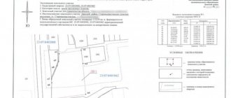
You can find out what the current status of land plots is by referring to the state cadastral register.
When it turns out that it is necessary to transfer the plot to the registered category, a petition is drawn up to a government agency to transfer the property to a conditionally permitted type.
After a decision has been made on the purpose of using the land, the procedure for changing the current category of allotment is launched, during which the grounds for the claim are clearly and legally stated.
A land area can be classified as registered only if the following mandatory conditions are met:
- the object is registered as the property (the land plot, which is the property of the municipality, must be registered as a lease);
- Land surveying work was carried out in relation to the territory.
The procedure for changing the category assumes that written consent is initially obtained from the owners or tenants of neighboring plots. When the territory is owned by several owners, permission must be obtained from each of them.
Since 2013, after the Law “On Land Management” came into force, no other additional permits or preliminary consents from local governments are required.
Next, a full package of documents is prepared for re-registration of the territory’s status:
- documentation establishing title and confirming the right to land;
- cadastral passport;
- extract from the Unified State Register of Real Estate;
- a document confirming the environmental impact assessment;
- receipt of payment of state duty;
- declaration (the basic document on the basis of which the right to change the accounting category is issued);
- a legally justified application to change the accounting category.
Having collected the above list of documents, you should contact the administration of the municipality with a request to review them. During the personal application, the applicant is given a receipt confirming the acceptance of documents.
Transfer of documents by post is allowed. In this case, a registered letter is sent with a notification and an inventory-attachment.
Next, within the time limits established by law, a hearing is convened and held, following which the applicant is notified of the decision. This can be either a positive answer or a reasoned refusal to change the registration category of the site.
We remind you that even if you thoroughly study all the data that is in the public domain, this will not replace the experience of professional lawyers! To get a detailed free consultation and resolve your issue as reliably as possible, you can contact specialists through the online form .
Consequences of establishing the status of a site as archival, what does this mean?
Establishment of boundaries (clarification) The state has launched a program of complete data entry into the cadastre in order to identify and fill in missing information regarding the boundaries of plots.
Many areas that did not go through the process of determining boundaries and area are recorded in the cadastre without indicating the coordinates of the boundaries or are entered inaccurately. If the boundaries of a previously registered land plot are not defined, it is necessary to make appropriate changes and clearly establish boundaries.
The consequences of inaccurate designation of plot boundaries may be the intentional or unintentional seizure of part of a nearby plot, discrepancy between the actual area and that inscribed in the title deed.
Also, if the boundaries are not determined accurately, payments for the use of land plots may be incorrectly calculated. In order to establish the exact area and boundaries of the site, it is necessary to carry out cadastral work to measure the territory.
Important
Previously registered plots underwent the registration procedure before a new legal act regulating issues related to real estate, or rights to which were acquired before March 1, 2008, came into force, but the objects were not subject to cadastral registration.
If land ownership has not been surveyed and cadastral work has not been carried out in relation to it, then it is recorded in the cadastre without designated boundaries. In order to determine the boundaries of the allotment, contact the specialists who carry out cadastral valuation work on your previously registered land.
Sometimes it is possible to change the status of registered or previously registered land to archival without filing applications when taking into account the rights to other objects formed from such property.
Temporary status of the land plot. What is this?
Thus, in the cadastral passport and cadastral extract there is an entry “Nature of state cadastral registration information (status of land plot registration).”
Land registration statuses can be “temporary”, “registered”, “previously recorded”, “archived” or “cancelled”. At first glance, the meaning of these terms is clear - these are areas that have already undergone the cadastral registration procedure.
But when and under what conditions the status of a land plot changes, it is useful to know about this. Federal Law of July 24.
2007 No. 221-FZ “On the State Real Estate Cadastre” (hereinafter referred to as the Law on the Cadastre), the concept of “temporary” status of information from the state real estate cadastre was first introduced. When registering a property, information about it is entered into the state real estate cadastre (GKN) as temporary.
The status of a land plot previously taken into account: what does it mean?
In order for them to cease to be temporary, the rights to such real estate must be registered in compliance with the procedure and deadline established by law. The period during which the registration of the right must be completed is 5 years from the date of registration of the land plot in the cadastral register.
Therefore, if a land plot has a “temporary” status on the cadastral register, the procedure for registering it must be continued, namely, registering the rights in the Unified State Register of Rights.
Otherwise, after 5 years, the land plot is automatically removed from the cadastral register and acquires the status of “cancelled”.
Land status
Attention
Issues of land relations are relevant and are under close government control.
Only after the formation of the state real estate cadastre was it possible to collect all data on real estate, including land plots, into a single complex.
However, the addition of database updates occurs constantly, which became the reason for the emergence of such a thing as a previously recorded land plot.
Important aspects Land plots classified as previously recorded are a relatively new concept for domestic legislative acts. What is it? Let's figure out what the difference is between a previously registered land plot and a registered one. Registered lands imply that complete information about their area, boundaries and other nuances are fully entered into the state cadastre. A document of ownership was also issued for them.
Status of a land plot - how to find out and how to use it for its intended purpose?
Current standards The registration process is regulated by the following legislative acts: Features of such property The State Property Committee contains data on lands marked “previously registered”.
This means that the cadastral registration of such plots was completed before the cadastral law came into force, or such lands were not registered, but the registration of ownership rights to them was started and not terminated.
Data on previously registered lands after the entry into force of the law were recorded in the real estate cadastre on the basis of an inventory, which means that the boundaries of the lands were not clearly delineated in accordance with legislative acts and did not have clear coordinates.
Also, incomplete information about the lands was entered into the cadastre from the data contained in the document on ownership of the site. Thus, according to statistics for 2021, land conflicts account for about 3% of the total number of civil cases considered by judicial institutions.
Based on the results of cases considered in the appellate court, the stability of court decisions on land proceedings is about 90%. We also note that until recently, court cases were dominated by boundary conflicts, land use procedures, and questions regarding the use of agricultural land.
However, today the main ones are restrictions on the rights to use land, carrying out the cadastral registration procedure to place previously registered plots on full cadastral registration. All legal claims regarding the rights and use of land plots are filed with the courts at the location of the site according to the rules of exclusive jurisdiction.
After collecting the required papers and, if necessary, performing additional activities (for example, land surveying), report to the authorized bodies to complete the procedure for registering rights to the site. Today, submitting documents is possible both directly through Rosreestr and through the MFC. Registration will cost the amount required by the state fee.
From the beginning of 2021, for citizens the cost of simplified registration is 350 rubles, regular registration – 2,000 rubles. For organizations, the state duty is much larger and equal to 22,000 rubles.
How to make a land survey application for land survey work can be done here. Execution of land survey work is within the competence of cadastral engineers - specialists who have passed the qualification exam, which gives the right to engage in the specified type of activity.
Therefore, the land survey will be completed in approximately one and a half months (if everything is done correctly and the Rosreestr body does not return the documents for corrections).
Is it possible to sell a registered land plot? If the land ownership belongs to the registered plots, you can dispose of such property at your own discretion: sell, donate, etc.
Make sure you have a set of papers to complete the transaction in advance.
Thus, if your allotment is not registered, deal with this issue first. Prepare a proper documentation package in advance, consisting of:
- document proving your identity. If you represent the interests of another person, you will need a notarized power of attorney;
- statements of intention to register ownership of a land plot;
- cadastral extract for land;
- a document on the transfer of ownership of land (for example, a purchase and sale agreement, donation, etc.);
- two copies of the payment document in relation to the state duty (original and copy).
applications for registration of ownership of a land plot can be found here. The alienator of the plot will have to present his identification document and title documents for land ownership. Land ownership may be in the status of:
- previously taken into account;
- taken into account;
- temporary;
- canceled;
- archival.
A change in the status of this entry may occur taking into account certain activities that give rise to legal consequences that have been committed in relation to the allotment or are planned to be committed. Thus, the status indicates the possibility of carrying out any actions with a specific plot of land.
What is the registered status of a land plot? After ownership of the plot is registered, the cadastral information receives the status “registered”.
When the owner of the land is the state or municipality, then this status is assigned after the lease agreement has passed the registration procedure.
Source: https://vip-real-estate.ru/2021/05/07/posledstviya-ustanovleniya-status-uchastka-arhivnyj-chto-eto-znachit/