Is it necessary to do land surveying if there is a certificate of ownership? In most situations this is not necessary. Often, when registering a cadastral passport, land surveying has already been completed. Nevertheless, there were a number of cases when it was quite possible to live without this procedure. However, real changes in legislation put an end to this important issue. Now, without land surveying, it will be impossible to dispose of the existing land. To obtain your rights in full, the procedure in question must now be carried out without fail. It is now impossible to do without land surveying and cadastral registration.
What is land surveying
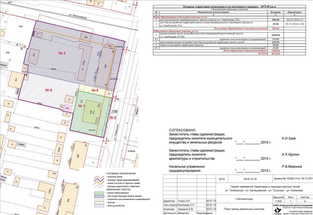
If we turn to terminology, land surveying is a geodetic term that denotes a whole range of services, including determining the boundaries of a site and calculating its perimeter.
The surveying operation must be carried out by a company with the appropriate license and permit.
The delineation of the perimeter of the site must be done using special tools, otherwise the results of the survey may be disputed.
In addition, the procedure cannot start without the consent of the BTI and neighbors.
And if the bureau specialists give consent without problems, a number of problems may arise with neighbors:

- the neighbors deliberately do not agree to the land survey - in this case, you will either have to persuade them after finding out the reason for the discontent, or deal with them in court;
- the neighbors have not lived for a long time, and their data is not available - this problem is “removed” by publishing a message in the media about the land survey, and if no one objects within 30 days, you can start.
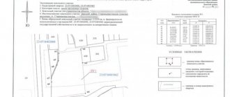
After carrying out the survey, surveyors will hand over to the owner a package of the so-called “land survey file”, with which you need to contact the cadastral chamber to prepare the following documents:
- land survey plan;
- extracts of ownership.
In addition, the plot will be assigned a cadastral number. These documents are valid for 5 years, after which they will need to be renewed.
Advantages and disadvantages of land surveying
This procedure, the need for which is now completely obvious, has positive as well as negative sides.
The first of these include the following:
- final decision on the establishment of site boundaries;
- completion of full legal registration of the land, making it possible to carry out various transactions with it;
- It is possible to carry out the procedure free of charge, at the expense of the municipal authorities.
Along with the benefits, there are also a number of negative aspects when carrying out land surveying:
- This procedure is not easy, it takes a lot of effort and time;
- due to the variability of legislation, it is easy to violate certain rules when registering;
- if the registration materials already contain information about land surveying, there is no point in doing it again;
- cadastral engineers who work for the municipality do not always have the required level of competence.
Of course, the existence of pros and cons of the procedure under consideration suggests that they need to be taken into account to the maximum extent when deciding on carrying out land surveying.
A cadastral passport without land surveying is insufficient taking into account new changes in legislation. Is land surveying necessary? The answer is obvious.
Why do you need to survey land?
Registration of ownership. Previously, plots for dachas were allocated not to individual citizens, but to a dacha cooperative. And it was the cooperative that owned it. The legislation does not prevent such plots from being registered as the property of their actual owners. To do this, you need to dissociate it and allocate a share. After this, the allocated share must be registered.- Transactions with previously recorded accounts. If the plot was registered under the dacha amnesty, most likely it was not surveyed. In 2021, the law was amended; it became impossible to make any transactions with such memory. Therefore, we recommend that you check whether your site has been demarcated. If this was not the case, it is better to set boundaries in advance.
- Division of the site. It is carried out during transactions with part of the land, when dividing property between spouses, etc. If the memory is divisible, it can be divided. The original memory is deregistered, new ones are registered. To carry out the procedure, you will need a boundary plan.
- Redistribution of land by consent of owners. This procedure is rarely performed. It may be necessary if the plots have jagged boundaries and a complex configuration. When there are no legal obstacles, new boundaries can be established and changes can be made to the Unified State Register.
- Consolidation of areas. For example, when relatives own neighboring plots, they can be combined into one. The cadastral engineer sets new boundaries. Old storage units are deregistered and a new one is registered.
- Disputes over borders. Unfortunately, boundary disputes can last for years. And if there is no accurate information about how the borders are drawn, it is very difficult to defend your rights. In dacha and garden partnerships there are very often blurred boundaries. Initially, the partnership was allocated territory, which was then divided up. As a result, there was only a general plan for these lands. There was no clear internal division.
Why is the procedure required?
Owners of suburban real estate often have questions about why they need land surveying. Although the law allows for the privatization of territories without fixing boundaries, there are still several situations when this must be done:
- this is required if it is necessary to conduct a purchase and sale transaction, donation, or surrender of a certain area of the site;
- if you plan to build a house or other object, so as not to violate the boundaries of neighbors.
It is believed that land surveying of dacha plots should be carried out even when there are difficulties with neighbors. If controversial issues arise, they can be resolved peacefully, without resorting to judicial authorities. After the procedure, it will be much easier to carry out various transactions with land: sale, exchange, donation.
Case studies
In recent years, land plots with and without land surveying have raised numerous questions among owners. Below are the most frequently asked questions.
Question: If there is a site plan, is it necessary to do land surveying?
Answer: The procedure may not be carried out if no transactions with the plot are planned. If you have a plan, you do not need to re-order the service.
Question: Is it necessary to survey the house on the site?
Answer: Happy owners of houses and cottages often wonder whether it is necessary to register ownership of the land that is located under the structure.
Even if they have documentation certifying ownership of the building, the site will still have to be measured additionally. In this case, a procedure is performed to identify the boundaries of the house.
Question: How do you know if you need to survey your dacha plot?
Answer: Each owner of a plot who does not have a land survey plan must receive it before March 2021. Otherwise, he will not be able to dispose of his real estate (land plot): sell, lease, donate, or inherit.
How to apply correctly in 2021
First, study the requirements for the site before dividing it.
I published 2 instructions because... Much depends on the number of owners. The instructions are suitable for different types of plots - individual housing construction, private household plots, SNT, etc.
Option No. 1 - when the site is owned by several owners
How to divide a plot if it is owned by several owners - the instructions are suitable for both common shared ownership and joint ownership. The design was laid out in 4 stages.
Option No. 2 - when there is one owner
How to divide a plot if it is owned by one owner. In this case, it is easier to divide the area; the instructions on the link are only 3 steps.
Other articles
How to register ownership of land plots - instructions, laws, cost. How to transfer a land plot: from private subsidiary plots to individual housing construction; with individual housing construction in private household plots; from individual housing construction to “commercial real estate”
Why is land surveying needed?
Many land owners live quietly without land surveying.
Due to the high cost and complexity of the procedure, many do not decide to do it unless absolutely necessary.
However, there is a list of situations in which land surveying will need to be carried out:

- for sale or donation of land;
- for renting out a plot;
- for organizing capital construction on a site (and not necessarily a house, we can talk about an extension or a bathhouse);
- during disputes with neighbors about the ownership of certain plots of land;
- when dividing or merging several areas;
- when allocating land from a collective property plot.
In case of a territorial dispute with neighbors, conducting a professional geodetic survey is perhaps the most effective way to resolve the conflict.
When constructing any buildings, especially long-term ones, it is also advisable to carry out land surveying, otherwise you may inadvertently go beyond the boundaries of the site - and this can lead to serious fines and significant hassle.
What it is
When talking about land surveying, usually everyone roughly understands what we might be talking about. But why is land surveying necessary?
Those who own land usually have a fairly clear understanding of exactly where its boundaries are. At first glance, the entire land surveying procedure boils down to simply entering these boundaries, which everyone knows about, into the cadastral passport. In fact, this is not the case at all. First of all, where the land of a given owner ends, the lands of other owners begin. When carrying out land surveying, it is necessary to obtain written, official consent from neighbors on where exactly to draw the appropriate boundary line.
There are two problems here:
- Often during the registration process, disagreements arise between neighbors regarding certain disputed areas. Such conflict situations need to be somehow judged and a fair, legal solution found. In particular, such disputes may be related to the fact that certain landmarks on the terrain in the boundary area, which were previously used as a guide, have now collapsed or moved to a new location.
- Sometimes undefined boundaries between plots overlap each other, making a certain plot included in two plots at once. It is possible that voids appear between the boundaries of plots that do not belong to anyone. This happens when the areas are not closely adjacent to each other. Of course, the cadastral engineer who carries out land surveying must look and make appropriate adjustments to the documents.
In addition to the above, when carrying out the procedure under consideration, it is necessary to schedule a general meeting where the owner of this site and his neighbors should meet to discuss the correct boundaries of the site. And the cadastral engineer must determine the boundaries on the ground.
This is done by determining the satellite coordinates of certain points on the border of the site, if this has not been done previously. An accurate description of all its boundaries will be based on them. In the process of these measurements, the coordinates were linked to satellite data.
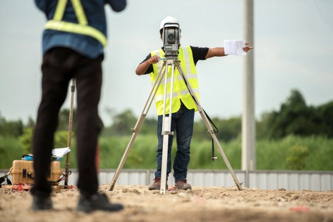
Cadastral work can only be carried out by someone who has a special license to carry it out.
What does the procedure consist of?
The procedure for land surveying a summer cottage in 2021 implies the following order of work:
- Preparatory stage. Before starting work, a thorough study of the technical documentation regarding the site, as well as its special topographical signs and geodesy boundaries, is carried out.
- A plan for carrying out boundary work is being developed. After approval of the plan, the owner is informed of the date and time of the visit of cadastral engineers.
- After this, neighbors are also notified about the upcoming procedure.
- Upon arrival, cadastral engineers establish the coordinates of the land plot, determine its exact area, and also prepare a drawing of the plot.
- If everything is done correctly and fully, the results of the work are agreed upon with the city municipal service.
After confirmation from the administration, the final documentation of the site plan and boundary work takes place.
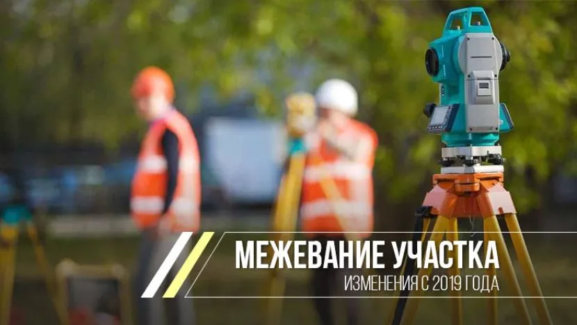
In 2021, changes were made to carry out the land surveying procedure Source yandex.net
Why do it if you have a number and a passport?
The land surveying procedure is not cheap. Therefore, let’s figure out why and whether it is necessary to delineate a plot if it has a number and a passport.
After the adoption of the Land Code, registration of land ownership was allowed under a simplified scheme. Federal Law No. 93 was adopted on this, which was called the “Law on Dacha Amnesty.”
According to the Land Code, when obtaining a certificate of ownership of a plot and issuing its cadastral passport, it is necessary to establish exact boundaries.
The “Law on Dacha Amnesty” (Article 9) introduced adjustments to this process. It was allowed not to carry out land surveying to obtain a cadastral passport in the following situations:
- if the territory was used for personal farming;
- the land was allocated for dacha partnerships;
- use of land for vegetable gardening and horticulture;
- construction of garages and individual housing construction.
In these cases, the cadastral passport was issued to the owner without establishing exact boundaries. Fr. was made in it.
The adopted Federal Law No. 447 dated December 22, 2014 introduces changes to the cadastral registration of real estate, including land. From 2021, no land transaction should be registered with a government agency without a land survey procedure.
The owner of a land plot cannot:
- sell your property;
- to rent;
- draw up a deed of gift;
- settle one's affairs;
- transfer the land as collateral for a loan.
If the owner of the plot does not intend to carry out all these operations in the coming years, then there is no need to urgently issue a new cadastral passport indicating the exact boundaries.
It is worth noting that before the onset of 2021, all of the above land transactions can be completed without carrying out survey work. But in this case, the cost of the plot will be slightly lower. The acquiring party will still have to do land surveying later.
Thus, it is not necessary to carry out land surveying if you have a cadastral number and passport before 2021, but certainly after it.
The delineation of land plots was carried out with violations and you do not agree with the new boundaries? It was a mistake?
Find out how to file a lawsuit to challenge the results of the procedure!
Who performs the procedure
Land surveying of dacha plots is carried out by many specialized companies. You can choose the right one based on the following criteria:
- there must be a license to carry out this type of work;
- it is important to have a positive story;
- it is necessary to choose a company with uninflated prices;
- In order not to solve many additional issues, you should find out what package of services is provided - full or partial.
The work is carried out by cadastral engineers. Specialists pass an exam for the right to carry out this activity. These are the types of employees that specialized companies hire. This ensures efficiency and excellent quality of operations.

And due to poor quality work, it will not be possible to register the plot, since the boundaries will intersect with neighboring plots. Therefore, it is important to choose specialists based on real reviews from acquaintances and friends. It is necessary to find out about the quality of the work performed and the timing of documentation.
Sample contract for land surveying
dogovor-na-megevanie-zemelnogo-uchastka.docx ≈ 24 KB
We do not recommend that you create the document yourself. Contact a lawyer!
Advantages of land surveying
Carrying out this procedure gives the owner of the site several advantages:

- Complete independence. The owner of the land can feel like a true owner; he will be able to dispose of the plot at his own discretion without the permission of the co-owners.
- Security. No one will be able to encroach on the demarcated plot of land.
- The territory is completely protected from foreign claims.
- Legitimization of the assigned territory. By law, the owner of a plot can increase his territory by 10% at the expense of no-man's land. This will not be considered an unauthorized seizure, but merely a clarification of the boundaries and adjustment of the area of the site. True, as the size of the plot increases, the costs of maintaining it will also increase - but that’s another story.
- It can be useful to carry out land surveying to ensure your own safety, for example, if mass construction and alienation of land begins in a populated area.
- Without documents in hand, a citizen will not be the owner of the land, even if he has lived on it for many years. Donation and inheritance of land will not be an argument either.
If boundaries are not established, such a tenant is considered an unauthorized invader of the territory, and neighbors or the municipality can easily take them away.
Thus, during the period of the “dacha amnesty,” many pensioners became victims of the tyranny of their own neighbors, who en masse transferred huge tracts of land into their names. Then they either lost their homes or suddenly became tenants on their own property.
Carrying out land surveying guarantees the integrity of the land and insures against all unforeseen situations.
The main advantages of land owners who carried out land surveying
Is land surveying necessary? Land owners immediately receive certain advantages and benefits:
- Feeling of complete independence.
- The ability to dispose of land at your own discretion without the consent of the co-owners.
- Security of the demarcated area from those wishing to take possession of this territory.
The owner of such a plot has an additional right to increase his territory by 10% if no-man's land is located next door. This action is not a spontaneous seizure. It qualifies as an adjustment or clarification of the boundaries of a land plot. At the same time, the area of the allotment increases, and hence the corresponding costs for its maintenance.
If land surveying is done, we can assume that by this action the owner has ensured his own safety. There are cases when, during mass construction in any locality, land is alienated without explanation.
Without documents on official land surveying, the owner may lose his rights even after owning the land plot for many years. Donation or inheritance are also not valid arguments.
It is useful to establish boundaries so as not to appear as an unauthorized invader of the territory, otherwise municipal authorities or neighbors may encroach on this plot.
Is land surveying necessary? Another aspect that speaks in favor of this event is the guarantee of the inviolability of the land and reliable insurance against unforeseen events and situations if land surveying is carried out.
What to consider
The stages of the land surveying procedure are regulated, but there may be nuances. They depend on why you need to survey the area. For example, For example, when allocating a share from the land of a dacha partnership, you need to obtain permission to carry out work.
Only the owner can give permission. You can find out who owns the land in an extract from the Unified State Register of Real Estate. Data from the register is in open databases, so anyone can request it, not just the owner. You can order an extract online, through a public card, the Rosreestr portal or other resources that cooperate with the portal.
Disadvantages of land surveying
But the procedure has its drawbacks:

- High cost of the operation. Land surveying often costs several tens of thousands of rubles, which in no way turn out to be “extra”.
- Possibility of conflict with neighbors. If they consider that the applicant is encroaching on their territory, then they may not give consent to the survey. Sometimes conflicts flare up for other reasons.
- Difficulties with co-owners. Especially if the site is collectively owned. The chairman of the partnership or board may simply not give consent.
- Removing infrastructure. Surveyors may require the site to be cleared of various infrastructure elements such as electrical poles or road surfaces. And this is not always possible.
The possibility of adding an additional 10% of the area to a plot of land is a positive factor for the initiator of the procedure, but a negative factor for neighbors.
After all, if they have not carried out land surveying, then the applicant can take possession of part of their plot legally.
Other problems when surveying land plots
The main problem that arises when surveying a land plot is exceeding the actual area. Federal Law No. 93 of June 30, 2006 “On amendments to certain legislative acts of the Russian Federation on the issue of registration in a simplified manner of citizens’ rights to certain real estate objects” states that the size of your plot can be adjusted upward by no more than to the minimum plot size established in accordance with the regulatory legal acts of self-government bodies or constituent entities of the Federation and only with the consent of these same bodies.
In everyday language this means that if the minimum size was 600 sq. m, then you can “cut” no more than 6 acres. But this is in theory; in practice, government officials are in no hurry to sign such acts.
When is it possible not to survey a plot of land?
Based on the provisions of the current legislation, land surveying is necessary if transactions with a land plot are planned. Under other circumstances, establishing the boundaries of the allotment can be delayed or this labor-intensive procedure can be abandoned altogether.
The list of such grounds is as follows:
- when privatizing a dacha plot in a simplified manner according to the “dacha amnesty” procedure. But in this case, you must prove that there are no controversial issues with your neighbors regarding the delimitation of land. For these purposes, you need to provide the cadastre authority with an agreement concluded with the owners of adjacent territories on the delimitation of plots. Along with this, documents confirming ownership of the plot must contain true information about the area of land and correspond to the information stated in the agreement with neighbors;
- if you are planning to start registering a house located on a plot of land. For these purposes, the procedure for separating an allotment of land from adjacent territories is not required; it is enough to present to the registration service a cadastral passport, a plan of the land allotment and all documents relating to the legality of the construction of a residential building.
Is land surveying necessary when selling a plot of land?
Is land surveying necessary if you have a cadastral passport? Read here.
Read about land surveying at the following link: